
TAKE YOUR OPERATION TO THE NEXT LEVEL
Ag-Nav Inc has proudly introduced AgMission to all aerial applicators.
AgMission is a web-app software centralizing all data related to aerial application. Data from flight planning to complete mission reporting can be entered and shared by all people who work on the same job.

Ag-Mission Use Worldwide
With over 250 active users during our BETA testing, Ag-Mission has seen great success among users worldwide.
Acres sprayed and counting
And more missions completed
EASY FLIGHT PLANNING
Mission or flight planning can be done well ahead of time. Spray areas, pivot areas, exclusion zones and buffer zones can be easily created on satellite image background. Just enter your address or Lat/Lon to get the map display.
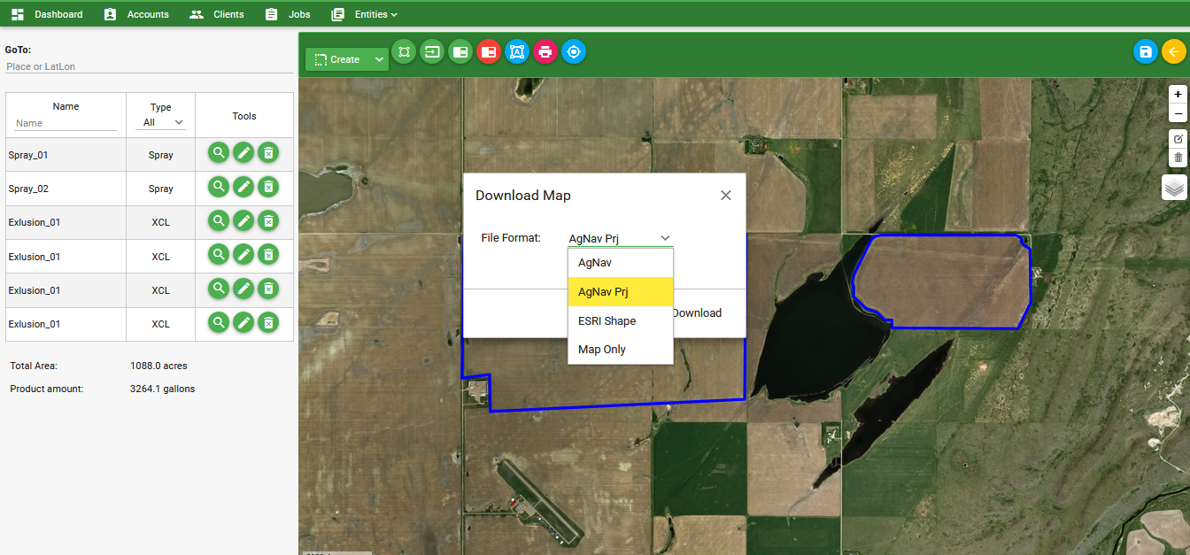
If you have existing Shape files (shp), Google files (kml/kmz), or AgNav files (no1/prj), you can upload them to AgMission to get the spray areas and exclusion zones on map.
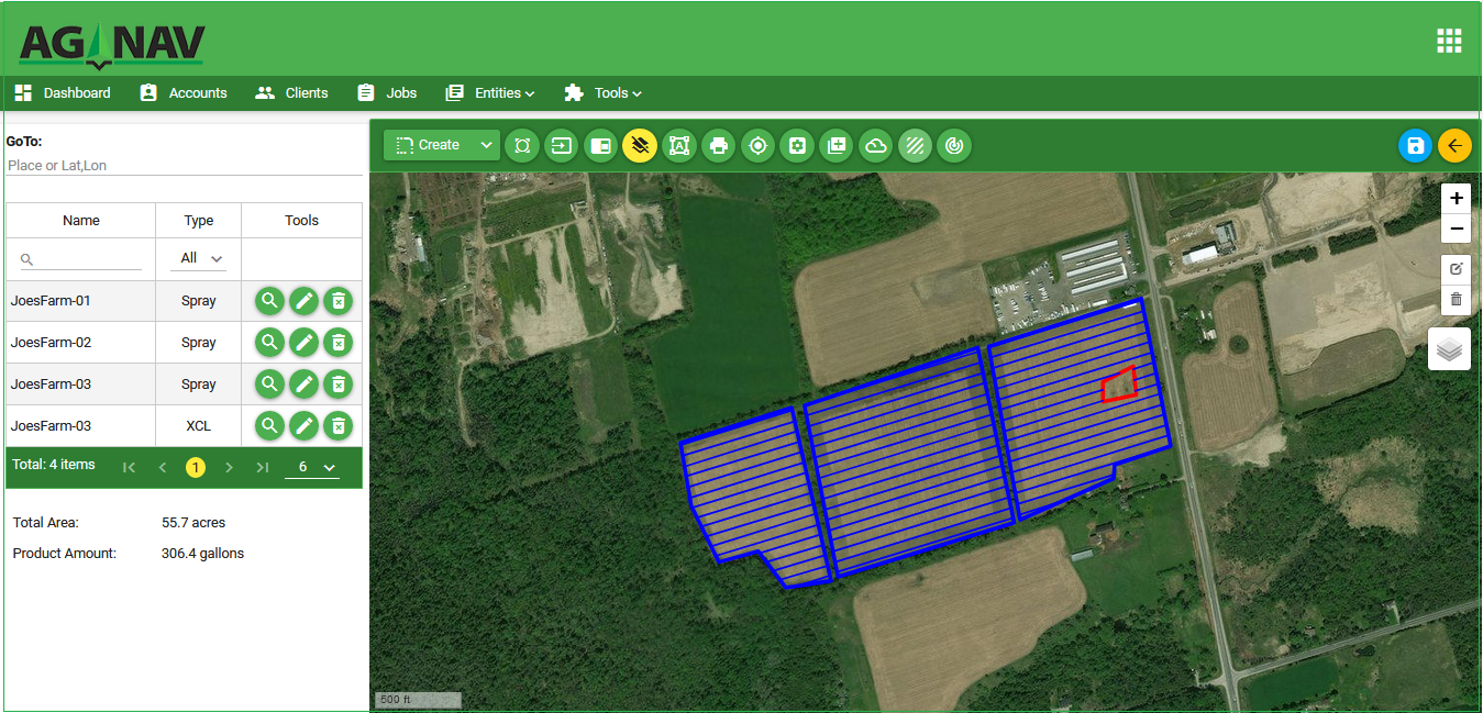
Easy Flight Line Generation
Flight lines can be generated based on the predefined swath width and line direction. Line direction can be the best heading calculated by AgMission, or the direction of AB line entered by you. Flight lines can generated on each spray area for spraying separately; or on all areas for spraying them together.
Simple Mission Process
Mission files and jobs can be assigned or sent directly to the Platinum and Platinum Lite navigation system via WiFi. Or, if internet access is not available at the work area files can be downloaded to a USB key to copy to the Platinum, Platinum Lite or Guia Gold/Silver. During flight, if a new job is sent, the pilot will be alerted to download it after landing.
Check us out on YouTube!
Master Your Ag-Nav System with Step-by-Step Video Guides
Want to get the most out of your Ag-Nav system? Our YouTube channel features quick, easy-to-follow video tutorials covering everything from Ag-Mission setup to in-field use of the Platinum console.
REVIEWS
We are constantly working on improving our products. Your voice matter.
We have found that AG-NAV has been outstanding both in support and development of the AG-NAV Guia System with no hesitation to continue improvements.
Mr. T. Wayne Gale - Director
Lee County Mosquito Control District
The system reliability is truly amazing. We've had very few problems with very adverse conditions. Doing government work, data exchange is much easier than the competitors' systems I've used.
Ken Slagel
K&K Aircraft Inc.
SUBSCRIPTION PLANS
Choose the best plan for you.

Send us an email and find out how Ag-Mission can benefit your business!
ABOUT
What is AG-NAV?
Phone: 705-734-0909
Toll-Free: 1-800-99-AG-NAV (24-628)
Cell (Spanish/Portuguese):
Fred: 416-434-1166
Cell (English):
Jose: 705-985-3477
Jason: 705-440-3477
Fred: 416-434-1166
Cell (Tagalog [Philippines]):
Jose: 705-985-3477
*Please do not solicit via this form*